July 2026 Gulf Coast Weather Update
El Niño Is Strengthening — Why Gulf Coast Hurricane Risk Is Not Gone
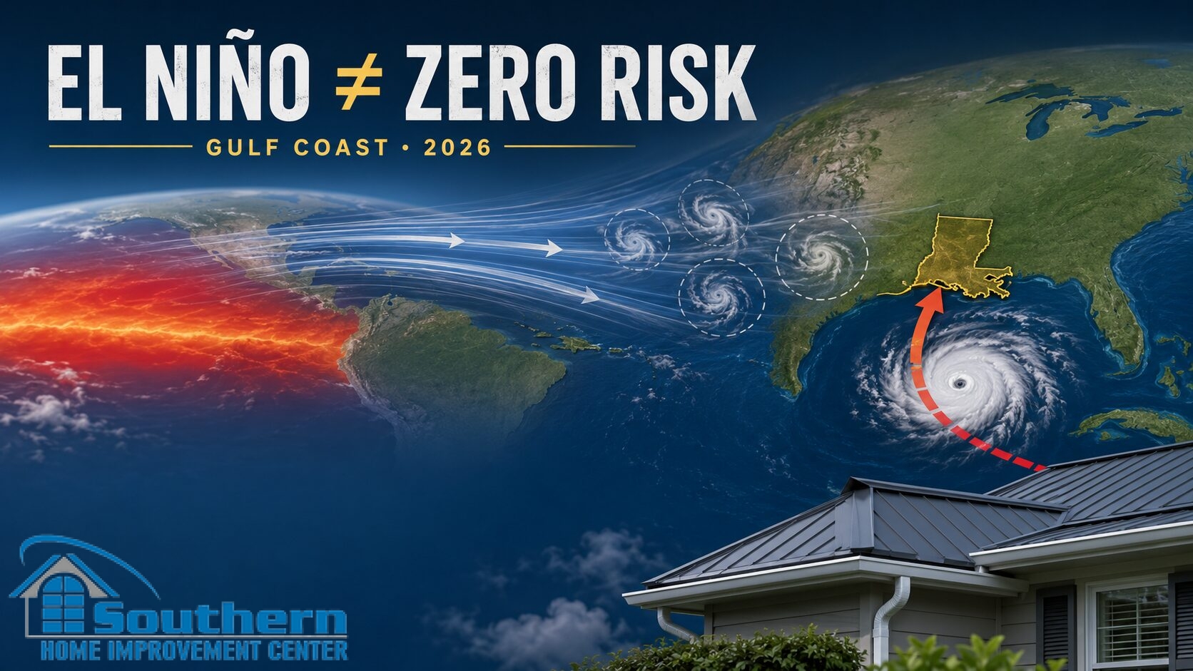
El Niño is strengthening in the Pacific, and that usually makes the Atlantic less favorable for tropical development. For homeowners in Louisiana and along the Mississippi Gulf Coast, however, a quieter basin does not mean a protected coastline. El Niño can influence how many storms form, but it cannot guarantee where the storms that do form will track or how a particular home will perform in wind-driven rain.
Quick Answer
Does El Niño eliminate hurricane risk for Louisiana and Mississippi?
No. El Niño often increases vertical wind shear over the tropical Atlantic, which can disrupt developing storms and reduce overall seasonal activity. It does not stop every storm from forming, prevent a Gulf Coast landfall, or predict damage at a specific property. The practical distinction is simple: seasonal storm count is a basin-wide forecast, while homeowners experience local wind, rain, debris, drainage and roof conditions at one address.
What Changed in the July 2026 El Niño Update?
Before the 2026 Atlantic hurricane season began, El Niño was part of the forecast. It is now an observed climate condition rather than only a possibility. NOAA announced in June that El Niño had formed, and the agency’s July update said the pattern was continuing to strengthen.
NOAA’s Climate Prediction Center reported a 97% chance that El Niño will persist through early spring 2027. It also placed the chance of a very strong El Niño during October through December 2026 at 81%. Those numbers describe confidence in the Pacific climate pattern. They are not probabilities that an individual Gulf Coast community will or will not be hit by a tropical storm or hurricane.
Climate Pattern
El Niño changes large-scale atmospheric conditions and often increases Atlantic wind shear.
Seasonal Activity
Those conditions can reduce the total number or strength of storms across the Atlantic basin.
Local Home Risk
Track, rainfall, wind direction, drainage and the condition of the home determine local impact.
Storm Count and Landfall Risk Are Different Questions
A seasonal outlook estimates activity across the entire Atlantic basin. It does not forecast which street, parish or county will experience the strongest conditions. A season can finish with fewer named storms than average and still include one consequential landfall.
This is the gap that short forecast summaries often leave unexplained. Fewer opportunities for storms to develop may reduce basin-wide activity, but the remaining storms are not distributed evenly across every coastline. Track matters. Timing matters. The condition of the property in the storm’s path matters.
Seasonal Outlook Answers
How active might the Atlantic basin be?
- Expected number of named storms
- Expected number of hurricanes
- Expected basin-wide accumulated activity
- Large-scale climate influences such as El Niño
Homeowner Decisions Require
What could happen at this property?
- Where a storm tracks and makes landfall
- How wind and rain reach the roof and walls
- Whether drainage can move heavy rainfall away
- Whether existing weak points are already present
A Louisiana Example
Hurricane Andrew Shows Why One Storm Can Define a Season
The 1992 Atlantic season had below-normal overall activity, but it produced Hurricane Andrew. After its catastrophic Florida landfall, Andrew crossed the Gulf and made a second United States landfall near Point Chevreuil, Louisiana, on August 26 as a Category 3 hurricane with sustained winds of 115 mph, according to the National Weather Service.
Andrew is not a forecast for 2026, and historical storms should not be used to predict a current track. It is useful because it demonstrates the difference between seasonal totals and local consequences. A low storm count did not make South Louisiana safe in 1992. The same reasoning applies whenever a quieter-season headline is interpreted as an all-clear.
The Climatological Peak of Hurricane Season Is Still Ahead
Late July can feel deep into hurricane season, especially after early named storms have already affected the Gulf Coast. The National Hurricane Center’s climatology shows a different timing picture: September 10 is the climatological peak of Atlantic hurricane season, with most activity occurring between mid-August and mid-October.
El Niño may make parts of that period less active than they otherwise would be, but the calendar still matters. Homeowners who have noticed a recurring ceiling stain, loose roof-edge material, gutter overflow, aging sealant, damaged flashing or a leak at a roof-to-wall transition still have a reason to address the condition before the most active portion of the season.
Early-season systems can expose drainage and rain-entry problems.
Most Atlantic tropical cyclone activity occurs during this period.
The official Atlantic hurricane season remains open.
Why the Northern Gulf Coast Still Requires Local Attention
El Niño influences the broad Atlantic environment, but Gulf Coast risk is also shaped by storm location, nearby water temperatures, steering patterns and how quickly conditions change near land. A recent AccuWeather update highlighted the possibility that systems forming or strengthening closer to the United States could leave less preparation time than a long-tracked storm crossing the Atlantic.
That does not mean rapid development near the Gulf Coast is certain. It means homeowners should not use a reduced seasonal count as a reason to postpone work on an already known exterior problem. Forecast confidence usually improves as a specific system forms and approaches; construction scheduling becomes harder when many homeowners wait for the same forecast cone.
What This Means Across SHIC’s Service Area
The same seasonal outlook can create different property concerns across Southeast Louisiana and coastal Mississippi. GEO relevance comes from the way homes are exposed, not from repeating city names.
Slidell, the Northshore and St. Tammany Parish
Tree exposure, wind-driven rain, roof-to-wall transitions and drainage around low areas can turn a limited storm impact into a property-specific problem.
New Orleans, Jefferson and St. Bernard
Closely spaced homes, mixed roof shapes, low-slope sections, older flashing and constrained drainage paths can affect how water moves during tropical rain.
Baton Rouge and Nearby Communities
Inland locations can still receive damaging gusts, falling limbs and repeated rain bands, especially when a Gulf system continues north after landfall.
Mississippi Gulf Coast
Homes in Hancock, Harrison and Jackson counties may face a combination of coastal wind, heavy rain, salt exposure and drainage pressure.
Use the Forecast to Choose the Right Next Step
A climate update by itself is not a reason to replace a roof. The right decision depends on the home’s present condition, its leak history and whether visible problems are isolated or part of a larger system issue.
Keep a current baseline
Maintain recent exterior photos, know the age and repair history of the roof, and follow official forecasts when a specific system develops.
Evaluate it before the seasonal peak
A repeated stain, loose flashing, lifted material, gutter separation or chronic overflow deserves a condition-based review rather than a decision based on storm-count headlines.
Do not wait for another named storm
Limit additional water entry when it is safe to do so and request a professional evaluation of the roof and connected exterior details.
Compare the complete roofing scope
Review the roof deck, underlayment, perimeter, flashing, penetrations, ventilation and drainage as a system. Homeowners considering stronger construction can also ask whether a FORTIFIED Roof™ path is appropriate for the project.
Three Mistakes to Avoid After a “Quieter Season” Headline
Assuming fewer storms means no Gulf landfall
A seasonal total cannot identify the final track of every storm that forms.
Waiting for a forecast cone to address an old leak
Once a system is approaching, inspection and repair schedules can tighten quickly.
Using climate news as a roof diagnosis
El Niño describes atmospheric conditions. It does not reveal the condition of shingles, flashing, decking, gutters or seals at a particular home.
Continue With the Right SHIC Resource
These pages separate the full seasonal forecast, the post-Bertha inspection path and the broader roofing service decision.
El Niño and Gulf Coast Hurricane Risk FAQ
Does El Niño stop Atlantic hurricanes from forming?
No. El Niño often increases vertical wind shear that makes Atlantic tropical development more difficult, but it does not eliminate every tropical storm or hurricane.
Can Louisiana or Mississippi still be hit during an El Niño year?
Yes. El Niño can reduce basin-wide activity without preventing a Gulf Coast landfall. Hurricane Andrew’s Category 3 Louisiana landfall during the below-normal 1992 season is a locally relevant historical example, not a prediction for 2026.
Is the 2026 Atlantic hurricane season past its peak?
No. The National Hurricane Center identifies September 10 as the climatological peak, with most Atlantic activity occurring from mid-August through mid-October. The official season continues through November 30.
Does a below-normal forecast mean my roof does not need attention?
No. A seasonal forecast does not evaluate roof condition. Decisions about maintenance, repair or replacement should be based on visible conditions, leak history, roof age, system details and a professional evaluation when needed.
Where should homeowners follow active storm information?
Use the National Hurricane Center and local National Weather Service offices for official watches, warnings, forecasts and storm-specific guidance. Seasonal outlooks are useful for planning, but active-storm decisions should follow current official information.
Sources Used for This July 2026 Update
SHIC reviewed current reporting together with primary NOAA and National Weather Service information. The official sources explain the climate pattern, season timing and historical Louisiana example; the current reports explain why the distinction between storm count and local exposure is receiving renewed attention.
Roof Concern Before Peak Season?
Request a Clear Roof and Exterior Evaluation
If your home already has a leak, visible roof concern, recurring drainage problem or storm-related exterior damage, Southern Home Improvement Center can review the condition and provide a practical repair or replacement estimate.
Request a Free Estimate